


|
|
|
 |
|||||||||||||
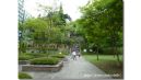
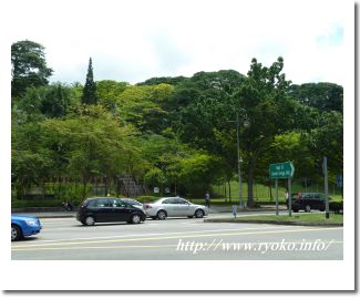
| Fort Canning Park is a park with a large site in the center of Singapore. Fort Canning Park is a place used as a fortress during British colonial era and is located on a hill. Currently it is maintained and plants and turf of the southern country mood are becoming beautiful parks, but facilities at the time such as cannons and lighthouse are still left. There is also an underground museum in the park and you can learn the history used as a fortress. Many people visit for walks, such as early in the morning, and it has become a place of rest for Singaporeans. |
|||||||||||||
 |
|||||||||||||
 |
|||||||||||||
 |
|||||||||||||
 |
|||||||||||||
|
Open Sightseeing Map (Big Map) |
|||||||||||||
|
|||||||||||||
|
|
   |